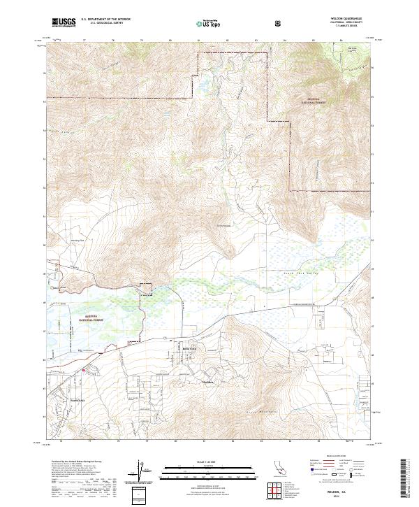
2021 Map of Weldon
USGS Topo · Published 2021About this map
Weldon and South Lake serve as the primary residential hubs along the southern edge of the South Fork Valley, where the mountain landscape transitions into a high-desert basin. The South Fork Kern River provides the vital hydrological backbone for the region, winding toward the expansive Hanning Flat and the northern reaches of South Lake. To the south, the Piute Mountains dominate the horizon, while the northern terrain is defined by the protected lands of the Sequoia National Forest, marked by numerous canyons such as Short Canyon and Burnt Canyon.
Find a feature on this map
86 named features on this map. Tap any name to fly to it.
Don’t see what you’re looking for? This feature index may not catch every label — zoom into the map to look around manually.
Map Details
Editions of this 2021 Weldon Map
This is the sole edition of this map. No revisions or reprints were ever made.
Other maps of this area

1906 · Kernville
USGS Topo · 1:125,000

1908 · Kernville
USGS Topo · 1:125,000

1943 · Onyx
USGS Topo · 1:62,500

1943 · Isabella
USGS Topo · 1:62,500

1948 · Bakersfield
USGS Topo · 1:250,000

1955 · Bakersfield
USGS Topo · 1:250,000

1956 · Bakersfield
USGS Topo · 1:250,000
1956 · Kernville
USGS Topo · 1:62,500
1956 · Lamont Peak
USGS Topo · 1:62,500

1960 · Bakersfield
USGS Topo · 1:250,000