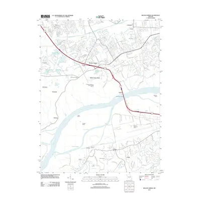
2012 Map of Weldon Spring
USGS Topo · Published 2012About this map
The Missouri River cuts a wide swath through this Saint Charles County landscape, separating the suburban growth of the north from the riverfront bottoms of the south. North of the river, the transition from industrial history to modern development is evident at the Weldon Spring Ordnance Works and the adjacent August A. Busch Wildlife Area. The map documents numerous small settlements and localized hubs such as Weldon Spring, Cottleville, and the riverside landing at Hamburg.
Find a feature on this map
111 named features on this map. Tap any name to fly to it.
Don’t see what you’re looking for? This feature index may not catch every label — zoom into the map to look around manually.
Map Details
Editions of this 2012 Weldon Spring Map
This is the sole edition of this map. No revisions or reprints were ever made.
Other maps of this area

1903 · O'Fallon
USGS Topo · 1:125,000

1931 · Manchester SE
USGS Topo · 1:24,000

1931 · Brussels
USGS Topo · 1:62,500

1932 · Manchester NE
USGS Topo · 1:24,000

1937 · Weldon Spring
USGS Topo · 1:24,000

1939 · Brussels
USGS Topo · 1:62,500

1940 · Eureka
USGS Topo · 1:24,000

1940 · Weldon Spring
USGS Topo · 1:24,000

1941 · Troy
USGS Topo · 1:62,500

1943 · Brussels
USGS Topo · 1:62,500