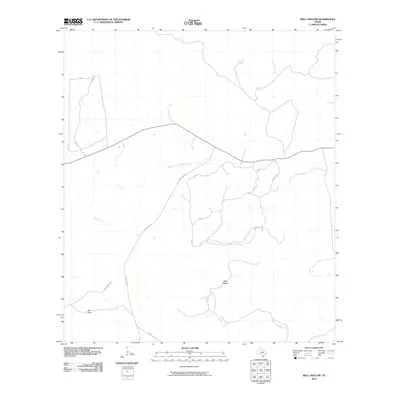
2010 Map of Well Hollow
USGS Topo · Published 2010About this map
Well Hollow serves as a central landmark in this portion of the Texas Hill Country, where complex drainage systems define the rugged topography. The map illustrates a significant hydrological divide, featuring the upper reaches of several major water systems. The South Fork Guadalupe River meanders through the central-north, while the southern reaches contain the headwaters of the North Prong Medina River. To the west, the arid landscape is carved by Frio Draw and the East Frio River. Transportation in this ranching-heavy region is dictated by the terrain, primarily serviced by Ranch Rd 187 and local routes like Haby Ranch Rd and Faulkner Rd S, which connect the isolated homesteads and grazing lands typical of Kerr County.
Find a feature on this map
15 named features on this map. Tap any name to fly to it.
Don’t see what you’re looking for? This feature index may not catch every label — zoom into the map to look around manually.
Map Details
Editions of this 2010 Well Hollow Map
This is the sole edition of this map. No revisions or reprints were ever made.
Other maps of this area

1894 · Kerrville
USGS Topo · 1:125,000

1954 · Llano
USGS Topo · 1:250,000

1954 · San Antonio
USGS Topo · 1:250,000

1955 · Llano
USGS Topo · 1:250,000

1956 · Tuff
USGS Topo · 1:62,500

1956 · Llano
USGS Topo · 1:250,000

1957 · San Antonio
USGS Topo · 1:250,000

1963 · Garven Store
USGS Topo · 1:24,000

1964 · Hillcrest Ranch
USGS Topo · 1:24,000

1964 · Circle Bluff
USGS Topo · 1:24,000