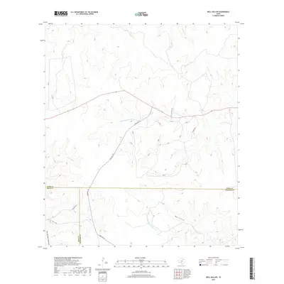
2019 Map of Well Hollow
USGS Topo · Published 2019About this map
The S Fork Guadalupe River and E Frio River define this high-elevation landscape where the headwaters of several major Texas drainage systems converge. Straddling the borders of Kerr, Real, and Bandera counties, the terrain is marked by deep incisions like Well Hollow and seasonal drainages such as Post Oak Waterhole Draw and Frio Draw. Access to this remote ranching country is provided by Ranch Rd 187, which winds through the hills alongside Haby Ranch Rd. The presence of the N Prong Medina River in the southeast corner further highlights the area's role as a critical watershed. The survey captures the contemporary road network, including Faulkner Rd S and Check Station Rd SW, serving local ranching interests in this sparsely populated portion of the Edwards Plateau.
Find a feature on this map
14 named features on this map. Tap any name to fly to it.
Don’t see what you’re looking for? This feature index may not catch every label — zoom into the map to look around manually.
Map Details
Editions of this 2019 Well Hollow Map
This is the sole edition of this map. No revisions or reprints were ever made.
Other maps of this area

1894 · Kerrville
USGS Topo · 1:125,000

1954 · Llano
USGS Topo · 1:250,000

1954 · San Antonio
USGS Topo · 1:250,000

1955 · Llano
USGS Topo · 1:250,000

1956 · Tuff
USGS Topo · 1:62,500

1956 · Llano
USGS Topo · 1:250,000

1957 · San Antonio
USGS Topo · 1:250,000

1963 · Garven Store
USGS Topo · 1:24,000

1964 · Hillcrest Ranch
USGS Topo · 1:24,000

1964 · Circle Bluff
USGS Topo · 1:24,000