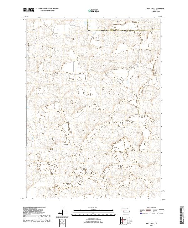
2021 Map of Well Valley
USGS Topo · Published 2021About this map
Well Valley and the surrounding landscape of the Nebraska Sandhills define this section of the High Plains along the border of Grant and Garden Counties. This 2021 survey illustrates a sparse ranching and grazing environment where life is centered around a series of low-lying depressions, including Dwire Valley and Green Valley. The presence of Ward Lake in the western portion of the map indicates the region's characteristic reliance on groundwater and seasonal basins. Transportation is maintained through a minimalist network of local routes such as Rd 193 and Rd 205, which navigate the undulating terrain to connect isolated ranch properties. The map captures the enduring rural character of this remote Nebraska landscape, highlighting the geographic features that have dictated settlement patterns for generations.
Find a feature on this map
16 named features on this map. Tap any name to fly to it.
Don’t see what you’re looking for? This feature index may not catch every label — zoom into the map to look around manually.
Map Details
Editions of this 2021 Well Valley Map
This is the sole edition of this map. No revisions or reprints were ever made.
Other maps of this area

1948 · George Lake
USGS Topo · 1:62,500

1949 · Rackett
USGS Topo · 1:62,500

1950 · Velma
USGS Topo · 1:62,500

1950 · George Lake
USGS Topo · 1:62,500

1950 · Longfellow Lake
USGS Topo · 1:62,500

1951 · Rackett
USGS Topo · 1:62,500

1954 · Scottsbluff
USGS Topo · 1:250,000

1954 · North Platte
USGS Topo · 1:250,000

1956 · North Platte
USGS Topo · 1:250,000

1957 · North Platte
USGS Topo · 1:250,000