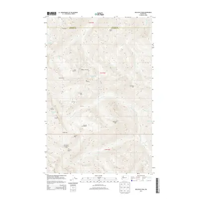
2014 Map of Wellesley Peak
USGS Topo · Published 2014About this map
Olympic National Park encompasses this high-altitude landscape where the headwaters of major river systems emerge from glaciers and snowfields. The transition between Clallam and Jefferson counties is defined by a series of prominent summits, including Mt Cameron, Wellesley Peak, and Mt Fromme. Glacial activity is still evident on this 2014 survey, with both the Lillian Glacier and Cameron Glaciers shown nestled among the peaks. These ice fields feed the Lillian River and Cameron Cr, which carve through deep valleys toward the lower elevations. The map reveals the logistical network used by backcountry travelers, centering on high-elevation crossings like Gray Wolf Pass and Lost Pass. Historic waypoint features like Bear Camp and the expansive Thousand Acre Meadow suggest the long-standing use of these routes by those navigating the inner reaches of the peninsula's mountainous core.
Find a feature on this map
41 named features on this map. Tap any name to fly to it.
Don’t see what you’re looking for? This feature index may not catch every label — zoom into the map to look around manually.
Map Details
Editions of this 2014 Wellesley Peak Map
This is the sole edition of this map. No revisions or reprints were ever made.
Other maps of this area

1938 · Mt Constance
USGS Topo · 1:125,000

1944 · Mt. Angeles
USGS Topo · 1:62,500

1946 · Mt. Angeles
USGS Topo · 1:62,500

1946 · Tyler Peak
USGS Topo · 1:62,500

1947 · The Brothers
USGS Topo · 1:62,500

1947 · Mt. Steel
USGS Topo · 1:62,500

1948 · Tyler Peak
USGS Topo · 1:62,500

1950 · The Brothers
USGS Topo · 1:62,500

1950 · Mt. Steel
USGS Topo · 1:62,500

1958 · Seattle
USGS Topo · 1:250,000