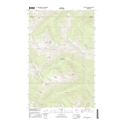
2017 Map of Wellesley Peak
USGS Topo · Published 2017About this map
Olympic National Park defines this 2017 survey, revealing a high-alpine landscape where glacial ice and mountain passes dictate the movement of water and travelers. The Dosewallips River and Gray Wolf River systems originate among the peaks, fed by the Cameron Glaciers near Mt Cameron. These river valleys are separated by formidable heights such as Mt Claywood and Mt Fromme, while the Pacific NW National Scenic Trail traverses the ridges to connect strategic crossing points like Gray Wolf Pass and Hayden Pass. The map highlights unique topographical features such as the Thousand Acre Meadow and Hatana Falls, illustrating the complex hydrology of the Olympic Mountains interior. This modern edition preserves the exact nomenclature of these remote summits and basins as they were officially recorded at the time of the survey.
Find a feature on this map
40 named features on this map. Tap any name to fly to it.
Don’t see what you’re looking for? This feature index may not catch every label — zoom into the map to look around manually.
Map Details
Editions of this 2017 Wellesley Peak Map
This is the sole edition of this map. No revisions or reprints were ever made.
Other maps of this area

1938 · Mt Constance
USGS Topo · 1:125,000

1944 · Mt. Angeles
USGS Topo · 1:62,500

1946 · Mt. Angeles
USGS Topo · 1:62,500

1946 · Tyler Peak
USGS Topo · 1:62,500

1947 · The Brothers
USGS Topo · 1:62,500

1947 · Mt. Steel
USGS Topo · 1:62,500

1948 · Tyler Peak
USGS Topo · 1:62,500

1950 · The Brothers
USGS Topo · 1:62,500

1950 · Mt. Steel
USGS Topo · 1:62,500

1958 · Seattle
USGS Topo · 1:250,000