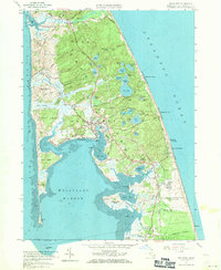
1958 Map of Wellfleet
USGS Topo · Published 1971About this map
Wellfleet and its surrounding harbor define this 1958 landscape, showing the town at a moment when traditional maritime geography met mid-century military and recreational growth. The presence of the U S Military Reservation Camp Wellfleet on the Atlantic coast contrasts with the older settlement patterns of South Wellfleet and Truro. For genealogists, the map preserves the locations of several burial grounds, including the South Wellfleet Cem and French Cem. The complex hydrology of the Outer Cape is visible through dozens of kettle ponds like Gull Pond and Horseleech Pond, alongside the winding Herring River. Infrastructure of the era is marked by the New York New Haven and Hartford rail line and land-use markers such as a Cranberry Bog and a Drive-in Theater. Coastal features like Lieutenant Island, Indian Neck, and the tidal flats of Wellfleet Harbor illustrate the shifting sands of the peninsula.
Find a feature on this map
89 named features on this map. Tap any name to fly to it.
Don’t see what you’re looking for? This feature index may not catch every label — zoom into the map to look around manually.
Map Details
Editions of this 1958 Wellfleet Map
3 editions found
Other maps of this area

1887 · Wellfleet
USGS Topo · 1:62,500

1887 · Provincetown
USGS Topo · 1:62,500

1889 · Provincetown
USGS Topo · 1:62,500

1889 · Wellfleet
USGS Topo · 1:62,500

1893 · Wellfleet
USGS Topo · 1:62,500

1898 · Provincetown
USGS Topo · 1:62,500

1942 · Cape Cod Bay
USGS Topo · 1:125,000

1942 · Nauset
USGS Topo · 1:125,000

1944 · Orleans
USGS Topo · 1:31,680

1944 · Wellfleet
USGS Topo · 1:31,680