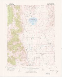
1957 Map of Wellington
USGS Topo · Published 1957About this map
Mining operations and irrigated agriculture define this 1957 landscape at the intersection of Douglas and Lyon counties. The Singatse Range is heavily marked by industrial activity, including the Ludwig (Site) and several adjacent excavations such as the Douglas Hill Mine and Casting Copper Mine. These sites are linked by an Old Railroad Grade that traces the base of the mountains, suggesting the era's reliance on rail transport for mineral extraction.
Find a feature on this map
57 named features on this map. Tap any name to fly to it.
Don’t see what you’re looking for? This feature index may not catch every label — zoom into the map to look around manually.
Map Details
Editions of this 1957 Wellington Map
4 editions found

Other maps of this area

1889 · Markleeville
USGS Topo · 1:125,000

1891 · Carson
USGS Topo · 1:125,000

1891 · Markleeville
USGS Topo · 1:125,000

1891 · Wabuska
USGS Topo · 1:125,000

1891 · Wellington
USGS Topo · 1:125,000

1893 · Carson
USGS Topo · 1:125,000

1893 · Markleeville
USGS Topo · 1:125,000

1893 · Wellington
USGS Topo · 1:125,000

1894 · Wabuska
USGS Topo · 1:125,000

1948 · Walker Lake
USGS Topo · 1:250,000