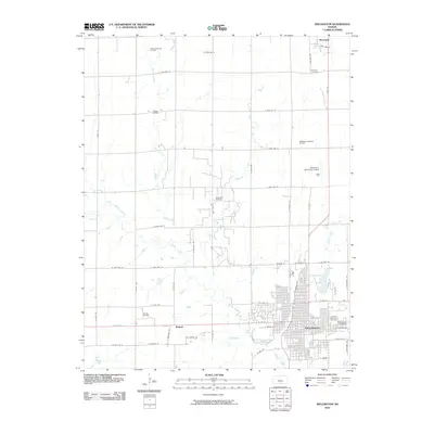
2010 Map of Wellington
USGS Topo · Published 2010About this map
Wellington serves as the focal point of this Sumner County landscape, anchored by a dense grid of streets including W Harvey Ave and E Lincoln Ave. The map captures a region where agriculture and energy production coexist, evidenced by the numerous petroleum operations scattered across the plains, such as the Wellington Oil Field, Treckell Oil Field, and the Anson Southeast Oil Field in the north. This industrial presence is balanced by the natural drainage of Slate Creek and Spring Creek, which meander through the section lines of the township.
Find a feature on this map
62 named features on this map. Tap any name to fly to it.
Don’t see what you’re looking for? This feature index may not catch every label — zoom into the map to look around manually.
Map Details
Editions of this 2010 Wellington Map
This is the sole edition of this map. No revisions or reprints were ever made.
Other maps of this area

1889 · Caldwell
USGS Topo · 1:125,000

1890 · Wellington
USGS Topo · 1:125,000

1893 · Caldwell
USGS Topo · 1:125,000

1897 · Caldwell
USGS Topo · 1:125,000

1955 · Belle Plaine
USGS Topo · 1:24,000
1955 · Zyba
USGS Topo · 1:24,000

1955 · Wichita
USGS Topo · 1:250,000

1958 · Wichita
USGS Topo · 1:250,000

1964 · South Haven NE
USGS Topo · 1:24,000

1964 · Dalton
USGS Topo · 1:24,000