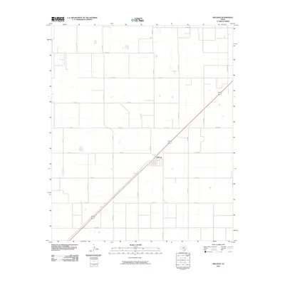
2010 Map of Wellman
USGS Topo · Published 2010About this map
Wellman serves as the primary hub of this Llano Estacado landscape, where a precise grid of rural roads defines the agricultural character of Terry County. The intersection of US Route 385 and Gaines Ave anchors the town, which is surrounded by an extensive network of county roads including Co Rd 305 and Co Rd 620. This 2010 survey shows the area's systematic organization, with secondary state routes like Fm 213 E and Fm 402 N cutting through the High Plains terrain. The map records several small water features scattered across the flats, typically found near the crossings of roads like Co Rd 480 and Co Rd 321. The settlement pattern reflects the enduring importance of the highway and ranch-to-market system, exemplified by Ranch Rd 303, which facilitates movement through this productive cotton-growing region.
Find a feature on this map
23 named features on this map. Tap any name to fly to it.
Don’t see what you’re looking for? This feature index may not catch every label — zoom into the map to look around manually.
Map Details
Editions of this 2010 Wellman Map
This is the sole edition of this map. No revisions or reprints were ever made.
Other maps of this area

1954 · Hobbs
USGS Topo · 1:250,000

1954 · Brownfield
USGS Topo · 1:250,000

1958 · Brownfield
USGS Topo · 1:250,000

1958 · Hobbs
USGS Topo · 1:250,000

1962 · Brownfield
USGS Topo · 1:250,000

1969 · Gomez
USGS Topo · 1:24,000

1969 · Foster
USGS Topo · 1:24,000

1969 · Loop
USGS Topo · 1:24,000

1969 · Ashmore
USGS Topo · 1:24,000

1969 · Wellman
USGS Topo · 1:24,000