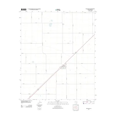
2012 Map of Wellman
USGS Topo · Published 2012About this map
Wellman sits at the intersection of local routes and ranch roads in this section of Terry County, characterized by a stark, systematic grid of agricultural and transport lines. The town layout is defined by streets such as 1st St, Terry Ave, and Lynn St, which cluster around the diagonal path of the highway. This arrangement highlights the town's role as a local crossroads within the larger landscape of West Texas ranching and farming operations. Outside the town center, a network of county roads including Co Rd-480 and Co Rd-600 partitions the land into large, uniform blocks. The presence of Old Hwy 62 alongside its modern counterpart illustrates the evolution of travel through this region. Scattered water features and depressions provide the only break in the geometric regularity of Ranch Road 402 and FM-213.
Find a feature on this map
31 named features on this map. Tap any name to fly to it.
Don’t see what you’re looking for? This feature index may not catch every label — zoom into the map to look around manually.
Map Details
Editions of this 2012 Wellman Map
This is the sole edition of this map. No revisions or reprints were ever made.
Other maps of this area

1954 · Hobbs
USGS Topo · 1:250,000

1954 · Brownfield
USGS Topo · 1:250,000

1958 · Brownfield
USGS Topo · 1:250,000

1958 · Hobbs
USGS Topo · 1:250,000

1962 · Brownfield
USGS Topo · 1:250,000

1969 · Gomez
USGS Topo · 1:24,000

1969 · Foster
USGS Topo · 1:24,000

1969 · Loop
USGS Topo · 1:24,000

1969 · Ashmore
USGS Topo · 1:24,000

1969 · Wellman
USGS Topo · 1:24,000