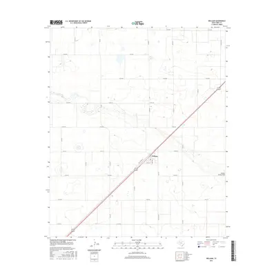
2016 Map of Wellman
USGS Topo · Published 2016About this map
Wellman serves as the primary hub of this Terry County landscape, situated at the intersection of several significant Texas farm-to-market and county roads. The settlement is organized around a traditional grid including 4th St, 8th St, and Terry Ave, adjacent to the diagonal path of Old US Hwy 62. The surrounding terrain is defined by the ephemeral path of Sulphur Springs Draw, which meanders across the southern portion of the quadrangle. This 2016 survey illustrates a highly structured agricultural environment, where the land is divided into large, uniform sections by an extensive network of rural roads such as Co Rd 600 and FM 402. The mapping of these routes, including Ranch Rd 303, underscores the importance of regional connectivity for the local farming community.
Find a feature on this map
28 named features on this map. Tap any name to fly to it.
Don’t see what you’re looking for? This feature index may not catch every label — zoom into the map to look around manually.
Map Details
Editions of this 2016 Wellman Map
This is the sole edition of this map. No revisions or reprints were ever made.
Other maps of this area

1954 · Hobbs
USGS Topo · 1:250,000

1954 · Brownfield
USGS Topo · 1:250,000

1958 · Brownfield
USGS Topo · 1:250,000

1958 · Hobbs
USGS Topo · 1:250,000

1962 · Brownfield
USGS Topo · 1:250,000

1969 · Gomez
USGS Topo · 1:24,000

1969 · Foster
USGS Topo · 1:24,000

1969 · Loop
USGS Topo · 1:24,000

1969 · Ashmore
USGS Topo · 1:24,000

1969 · Wellman
USGS Topo · 1:24,000