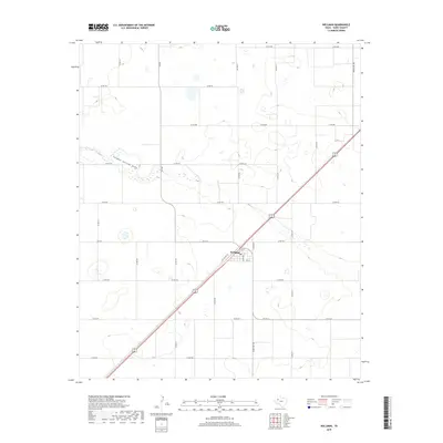
2019 Map of Wellman
USGS Topo · Published 2019About this map
Wellman serves as the central hub of this Terry County landscape, where the local street grid including Terry Ave and Gaines Ave meets the diagonal path of the highway. The surrounding terrain is defined by the ephemeral path of Sulphur Springs Draw, which meanders across the northern portion of the quadrangle. This area of the Llano Estacado is partitioned by an extensive network of rural roads such as Co RD 480 and FM 402, reflecting the organized agricultural geometry typical of the Texas Panhandle. The alignment of Old US Hwy 62 through the center of the settlement provides a clear record of the historical transportation corridor that sustained this community through the early 21st century.
Find a feature on this map
27 named features on this map. Tap any name to fly to it.
Don’t see what you’re looking for? This feature index may not catch every label — zoom into the map to look around manually.
Map Details
Editions of this 2019 Wellman Map
This is the sole edition of this map. No revisions or reprints were ever made.
Other maps of this area

1954 · Hobbs
USGS Topo · 1:250,000

1954 · Brownfield
USGS Topo · 1:250,000

1958 · Brownfield
USGS Topo · 1:250,000

1958 · Hobbs
USGS Topo · 1:250,000

1962 · Brownfield
USGS Topo · 1:250,000

1969 · Gomez
USGS Topo · 1:24,000

1969 · Foster
USGS Topo · 1:24,000

1969 · Loop
USGS Topo · 1:24,000

1969 · Ashmore
USGS Topo · 1:24,000

1969 · Wellman
USGS Topo · 1:24,000