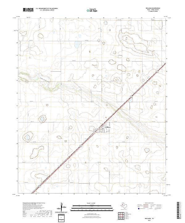
2022 Map of Wellman
USGS Topo · Published 2022About this map
Wellman serves as the central hub of this South Plains landscape, where the intersection of Old US Hwy 62 and Fm 213 E marks the heart of the community. The town layout is clearly defined by local thoroughfares such as Gaines Ave, Terry Ave, 4th St, and 8th St. Beyond the residential and commercial cluster of the town site, the geography is characterized by an extensive network of county roads and agricultural land. The most prominent natural feature is the winding course of Sulphur Springs Draw, which cuts across the northern half of the region. This ephemeral drainage system provides a distinct contrast to the rigid grid of the surrounding section lines, such as Co Rd 600 and Ranch Rd 303, illustrating the persistent influence of the High Plains topography on local transportation and land use patterns.
Find a feature on this map
28 named features on this map. Tap any name to fly to it.
Don’t see what you’re looking for? This feature index may not catch every label — zoom into the map to look around manually.
Map Details
Editions of this 2022 Wellman Map
This is the sole edition of this map. No revisions or reprints were ever made.
Other maps of this area

1954 · Hobbs
USGS Topo · 1:250,000

1954 · Brownfield
USGS Topo · 1:250,000

1958 · Brownfield
USGS Topo · 1:250,000

1958 · Hobbs
USGS Topo · 1:250,000

1962 · Brownfield
USGS Topo · 1:250,000

1969 · Gomez
USGS Topo · 1:24,000

1969 · Foster
USGS Topo · 1:24,000

1969 · Loop
USGS Topo · 1:24,000

1969 · Ashmore
USGS Topo · 1:24,000

1969 · Wellman
USGS Topo · 1:24,000