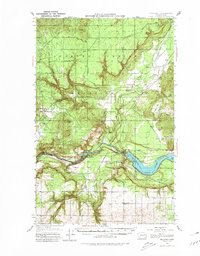
1953 Map of Wellpinit
USGS Topo · Published 1980About this map
The Spokane Indian Reservation dominates this mid-century landscape, centered on the community of Wellpinit. The geography is defined by the sharp descent from high timbered terrain like Round Mtn and Sherwood Lookout toward the southern boundary formed by the Spokane River. Along the river’s course, the transition from moving water to the still reaches of Long Lake is marked by Little Falls, reflecting the area's hydroelectric and hydraulic character.
Find a feature on this map
31 named features on this map. Tap any name to fly to it.
Don’t see what you’re looking for? This feature index may not catch every label — zoom into the map to look around manually.
Map Details
Editions of this 1953 Wellpinit Map
3 editions found

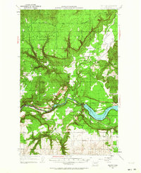
Other maps of this area

1927 · Chewelah
USGS Topo · 1:125,000

1930 · Chewelah
USGS Topo · 1:125,000

1943 · Medical Lake
USGS Topo · 1:62,500

1944 · Clayton
USGS Topo · 1:62,500

1944 · Wellpinit
USGS Topo · 1:62,500

1945 · Reardan
USGS Topo · 1:62,500

1948 · Hunters
USGS Topo · 1:62,500

1948 · Turtle Lake
USGS Topo · 1:62,500

1950 · Turtle Lake
USGS Topo · 1:62,500

1950 · Hunters
USGS Topo · 1:62,500