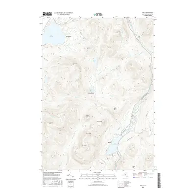
2016 Map of Wells
USGS Topo · Published 2016About this map
Speculator and Wells anchor this survey of Hamilton County, following the north-south corridor defined by the Sacandaga River. The landscape is dominated by significant peaks such as Hamilton Mtn and Speculator Mtn, which frame a network of waterways including Lake Pleasant and Lake Algonquin. These water bodies are connected by numerous tributaries like Sucker Brook and Elbow Cr, illustrating the drainage patterns of this high-elevation terrain.
Find a feature on this map
54 named features on this map. Tap any name to fly to it.
Don’t see what you’re looking for? This feature index may not catch every label — zoom into the map to look around manually.
Map Details
Editions of this 2016 Wells Map
This is the sole edition of this map. No revisions or reprints were ever made.
Other maps of this area

1898 · Thirteenth Lake
USGS Topo · 1:62,500

1899 · Indian Lake
USGS Topo · 1:62,500

1902 · Indian Lake
USGS Topo · 1:62,500

1907 · Lake Pleasant
USGS Topo · 1:62,500

1910 · Stony Creek
USGS Topo · 1:62,500

1950 · Utica
USGS Topo · 1:250,000

1954 · Lake Pleasant
USGS Topo · 1:62,500

1954 · Thirteenth Lake
USGS Topo · 1:62,500

1954 · Indian Lake
USGS Topo · 1:62,500

1954 · Harrisburg
USGS Topo · 1:62,500