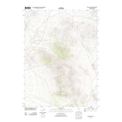
2012 Map of Wells Peak
USGS Topo · Published 2012About this map
Wells Peak anchors this high-desert landscape in eastern Elko County, where water sources dictate the geography of human activity and survival. In a region where reliable moisture is scarce, the map identifies critical points such as Quilici Spring, Summit Springs, Wilson Spring, and Cricket Spring. These water features likely served as vital landmarks for early ranchers and travelers navigating this corner of the Great Basin.
Find a feature on this map
11 named features on this map. Tap any name to fly to it.
Don’t see what you’re looking for? This feature index may not catch every label — zoom into the map to look around manually.
Map Details
Editions of this 2012 Wells Peak Map
This is the sole edition of this map. No revisions or reprints were ever made.
Other maps of this area

1955 · Wells
USGS Topo · 1:250,000

1958 · Wells
USGS Topo · 1:250,000

1961 · Wells
USGS Topo · 1:250,000

1968 · Moor Summit
USGS Topo · 1:24,000

1968 · Holborn
USGS Topo · 1:24,000

1968 · Wells
USGS Topo · 1:24,000

1968 · Melandco
USGS Topo · 1:24,000
1968 · Pequop Summit SW
USGS Topo · 1:24,000

1968 · Wells Peak
USGS Topo · 1:24,000

1968 · Summer Camp
USGS Topo · 1:24,000