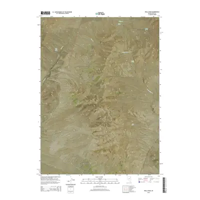
2014 Map of Wells Peak
USGS Topo · Published 2014About this map
Wells Peak stands as the central landmark in this high-desert region of Elko County, anchoring the eastern reach of the Windermere Hills. The landscape is defined by its vital water sources, with several named springs indicating the historical importance of water for livestock and travel in this arid Great Basin environment. High-elevation drainage networks, including Independence Cr and Town Cr, carve through the terrain, while reliable water points like Town Creek Spring, Wilson Spring, and Summit Springs provide critical markers across the high country. This survey illustrates the complex topography of the range, showing the drainages that flow from the peaks down toward the surrounding basins, serving as a record of the natural hydrology that has dictated land use in this part of Nevada for generations.
Find a feature on this map
16 named features on this map. Tap any name to fly to it.
Don’t see what you’re looking for? This feature index may not catch every label — zoom into the map to look around manually.
Map Details
Editions of this 2014 Wells Peak Map
This is the sole edition of this map. No revisions or reprints were ever made.
Other maps of this area

1955 · Wells
USGS Topo · 1:250,000

1958 · Wells
USGS Topo · 1:250,000

1961 · Wells
USGS Topo · 1:250,000

1968 · Moor Summit
USGS Topo · 1:24,000

1968 · Holborn
USGS Topo · 1:24,000

1968 · Wells
USGS Topo · 1:24,000

1968 · Melandco
USGS Topo · 1:24,000
1968 · Pequop Summit SW
USGS Topo · 1:24,000

1968 · Wells Peak
USGS Topo · 1:24,000

1968 · Summer Camp
USGS Topo · 1:24,000