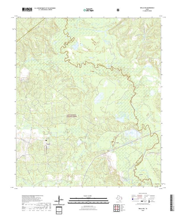
2022 Map of Wells SW
USGS Topo · Published 2022About this map
The Neches River winds through the heart of the Davy Crockett National Forest, forming a complex network of wetlands and oxbows along the borders of Houston, Trinity, and Angelina counties. This landscape is defined by its seasonal watercourses, including the extensive Boggy Slough and the winding Old Channel, which illustrate the shifting nature of the river's path over time. In the western portion of the forest, local landmarks like the New Church and New Church Cem provide specific points of interest for genealogists tracing family histories in this rural timber region.
Find a feature on this map
36 named features on this map. Tap any name to fly to it.
Don’t see what you’re looking for? This feature index may not catch every label — zoom into the map to look around manually.
Map Details
Editions of this 2022 Wells SW Map
This is the sole edition of this map. No revisions or reprints were ever made.
Other maps of this area

1949 · Clawson
USGS Topo · 1:24,000

1949 · Keltys
USGS Topo · 1:24,000

1950 · Keltys
USGS Topo · 1:24,000

1950 · Clawson
USGS Topo · 1:24,000

1950 · Kennard NE
USGS Topo · 1:24,000

1950 · Centralia
USGS Topo · 1:24,000

1951 · Wells
USGS Topo · 1:24,000

1951 · Wells SW
USGS Topo · 1:24,000

1951 · Centralia
USGS Topo · 1:24,000

1951 · Kennard NE
USGS Topo · 1:24,000