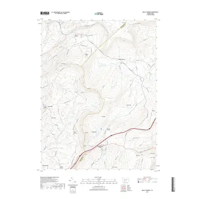
2019 Map of Wells Tannery
USGS Topo · Published 2019About this map
Wells Tannery and the surrounding Ridge-and-Valley terrain of the Bedford and Fulton county line are documented in this contemporary 2019 survey. The map details a landscape defined by significant infrastructure and historical local nodes, from the Rays Hill Tunnel and Sideling Hill Tunnel to small settlements like Valley-Hi and Old Mountain House. Genealogists will find exceptional value in the numerous documented burial sites, including the Shermans Valley Church Graveyard and Mount Zion Lutheran Church Cem, along with the Hinish Cem near Rays Hill. The drainage patterns are clearly marked by Oregon Creek and Wooden Bridge Cr, while the high ridges of Harbor Mtn and Sideling Hill dictate the placement of winding mountain roads. This record captures the modern footprint of Breezewood and Graceville at a time of continued reliance on these narrow mountain passes and historic transport corridors.
Find a feature on this map
89 named features on this map. Tap any name to fly to it.
Don’t see what you’re looking for? This feature index may not catch every label — zoom into the map to look around manually.
Map Details
Editions of this 2019 Wells Tannery Map
This is the sole edition of this map. No revisions or reprints were ever made.
Other maps of this area

1900 · Everett
USGS Topo · 1:62,500

1902 · Everett
USGS Topo · 1:62,500

1925 · Needmore
USGS Topo · 1:48,000

1927 · Clearville
USGS Topo · 1:48,000

1930 · Broad Top
USGS Topo · 1:62,500

1931 · Clearville
USGS Topo · 1:62,500

1933 · Broad Top
USGS Topo · 1:62,500

1935 · Needmore
USGS Topo · 1:62,500

1939 · Needmore
USGS Topo · 1:62,500

1944 · Clearville
USGS Topo · 1:62,500
Featured Places
- Valley-Hi, PA
- East Providence Township, PA
- Graceville, East Providence Township
- Old Mountain House, Brush Creek Township
- Sandy Run, Broad Top Township