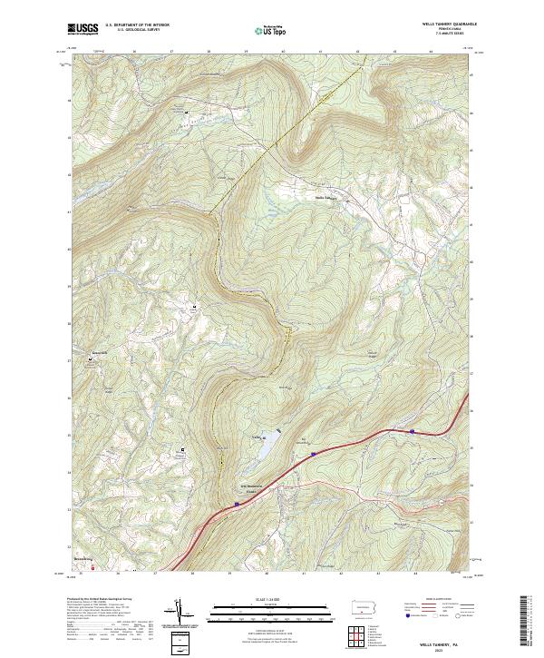
2023 Map of Wells Tannery
USGS Topo · Published 2023About this map
Wells Tannery sits at a crossroads of rugged terrain where the ridge-and-valley province of Pennsylvania meets the Bedford and Fulton County line. This landscape is defined by the massive parallel heights of Kimber Mountain, Sideling Hill, and Rays Hill, which channel the flow of waters like Tub Mill Run and Sherman Valley Run. The presence of the Old Mountain House and the numerous small graveyards, such as the Mountain Chapel Church Cem and Shermans Valley Church Graveyard, speak to generations of rural settlement clustered in the more hospitable lowland gaps. While modern transport corridors now cut through the ridges, the map preserves the traditional orientation of place-names like Graceville and Valley-Hi, showing how topography dictated the placement of early mountain churches and family burial grounds in this corner of the Commonwealth.
Find a feature on this map
91 named features on this map. Tap any name to fly to it.
Don’t see what you’re looking for? This feature index may not catch every label — zoom into the map to look around manually.
Map Details
Editions of this 2023 Wells Tannery Map
This is the sole edition of this map. No revisions or reprints were ever made.
Other maps of this area

1900 · Everett
USGS Topo · 1:62,500

1902 · Everett
USGS Topo · 1:62,500

1925 · Needmore
USGS Topo · 1:48,000

1927 · Clearville
USGS Topo · 1:48,000

1930 · Broad Top
USGS Topo · 1:62,500

1931 · Clearville
USGS Topo · 1:62,500

1933 · Broad Top
USGS Topo · 1:62,500

1935 · Needmore
USGS Topo · 1:62,500

1939 · Needmore
USGS Topo · 1:62,500

1944 · Clearville
USGS Topo · 1:62,500
Featured Places
- Valley-Hi, PA
- East Providence Township, PA
- Broad Top Township, PA
- Wells Township, PA
- Brush Creek Township, PA