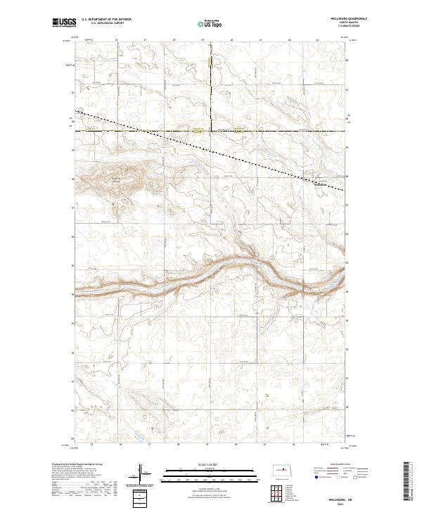
2024 Map of Wellsburg
USGS Topo · Published 2024About this map
Wellsburg stands as the primary settlement within this central North Dakota landscape, situated near the intersection of several section roads in Wells County. The topography is defined by the winding course of the Sheyenne River, which cuts a narrow valley through the plains in the southern portion of the quadrangle. North of the river, the prominent height of Butte de Morale provides a significant landmark overlooking the surrounding prairie. This area reflects a highly organized township-and-range agricultural system, with a dense grid of local roads like 31st St NE and 35th Ave NE providing access to farmlands. Conservation efforts are evident in the south, where the Wells County Waterfowl Production Area occupies the wetlands and drainage basins, preserving critical habitat within this productive grain-growing region.
Find a feature on this map
28 named features on this map. Tap any name to fly to it.
Don’t see what you’re looking for? This feature index may not catch every label — zoom into the map to look around manually.
Map Details
Editions of this 2024 Wellsburg Map
This is the sole edition of this map. No revisions or reprints were ever made.
Other maps of this area

1941 · Selz
USGS Topo · 1:62,500

1943 · Maddock
USGS Topo · 1:62,500

1945 · Maddock
USGS Topo · 1:62,500

1945 · Manfred
USGS Topo · 1:62,500

1948 · Fessenden
USGS Topo · 1:62,500

1948 · Manfred
USGS Topo · 1:62,500

1949 · Fessenden West
USGS Topo · 1:24,000

1950 · Wellsburg
USGS Topo · 1:24,000

1950 · Manfred NW
USGS Topo · 1:24,000

1950 · Manfred
USGS Topo · 1:24,000