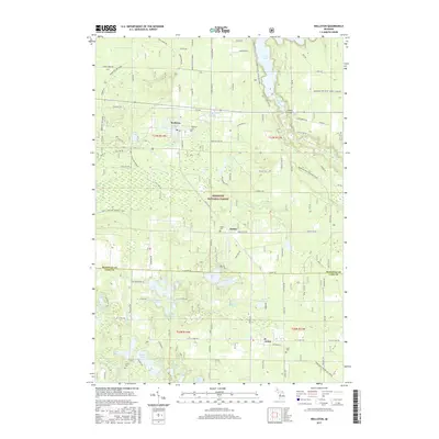
2017 Map of Wellston
USGS Topo · Published 2017About this map
Manistee National Forest encompasses the vast majority of this landscape, where the Pine River flows toward the prominent Tippy Dam in the northeast. The settlement of Wellston sits at the heart of the northern half, serving as a gateway to the dense network of interior lakes including Crystal Lake, Cranberry Lake, and Star Lake. The southern portion of the sheet transitions across the Manistee Co Lake Co line into the community of Irons, with the small settlement of Dublin positioned between the two.
Find a feature on this map
84 named features on this map. Tap any name to fly to it.
Don’t see what you’re looking for? This feature index may not catch every label — zoom into the map to look around manually.
Map Details
Editions of this 2017 Wellston Map
This is the sole edition of this map. No revisions or reprints were ever made.
Other maps of this area

1932 · Freesoil SE
USGS Topo · 1:31,680

1933 · Peacock SE
USGS Topo · 1:31,680

1933 · Peacock SW
USGS Topo · 1:31,680

1933 · Peacock NE
USGS Topo · 1:31,680

1933 · Peacock NW
USGS Topo · 1:31,680

1954 · Traverse City
USGS Topo · 1:250,000

1954 · Manitowoc
USGS Topo · 1:250,000

1956 · Onekama
USGS Topo · 1:62,500

1957 · Freesoil
USGS Topo · 1:62,500

1957 · Copemish
USGS Topo · 1:62,500