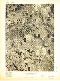
1976 Map of Wellston NW
USGS Topo · Published 1976About this map
Wellston and its surrounding northern Michigan woodlands are captured in this mid-1970s orthophoto, a transitional mapping style that overlays precise survey data onto actual aerial imagery. The settlement patterns in this corner of Manistee County reflect a landscape of scattered clearings and dense reforestation, with the meandering eastern shore of Tippy Dam Pond dominating the northeastern quadrant. The imagery clearly distinguishes between evergreen stands and deciduous growth, providing an unfiltered view of the terrain around Dublin and Irons as it existed before decades of modern development. Because this is an orthophotoquad, researchers can see the literal footprint of the era's land use, from the precise grid of forest roads to the individual structures that comprised these rural communities.
Find a feature on this map
4 named features on this map. Tap any name to fly to it.
Don’t see what you’re looking for? This feature index may not catch every label — zoom into the map to look around manually.
Map Details
Editions of this 1976 Wellston NW Map
This is the sole edition of this map. No revisions or reprints were ever made.
Other maps of this area

1932 · Freesoil SE
USGS Topo · 1:31,680

1933 · Peacock SE
USGS Topo · 1:31,680

1933 · Peacock SW
USGS Topo · 1:31,680

1933 · Peacock NE
USGS Topo · 1:31,680

1933 · Peacock NW
USGS Topo · 1:31,680

1954 · Traverse City
USGS Topo · 1:250,000

1954 · Manitowoc
USGS Topo · 1:250,000

1956 · Onekama
USGS Topo · 1:62,500

1957 · Freesoil
USGS Topo · 1:62,500

1957 · Copemish
USGS Topo · 1:62,500