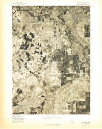
1976 Map of Wellston SW
USGS Topo · Published 1976About this map
Peacock stands as the primary settlement on this 1976 orthophotograph, situated within a landscape characterized by diverse vegetation patterns and clearings. The intricate path of the Little Manistee River winds through the northern portion of the quadrangle, its channel defined by the contrast of the riparian corridor against the surrounding terrain. This advance print provides a clear overhead view of the land use in Lake County during the mid-1970s, revealing the intersection of rural roads and the natural drainage patterns of the river basin. The imagery documents the extent of forest cover and open fields, offering a precise visual record of the region's geography before later decades of growth and reforestation altered these specific land boundaries.
Find a feature on this map
2 named features on this map. Tap any name to fly to it.
Don’t see what you’re looking for? This feature index may not catch every label — zoom into the map to look around manually.
Map Details
Editions of this 1976 Wellston SW Map
This is the sole edition of this map. No revisions or reprints were ever made.
Other maps of this area

1931 · Baldwin NW
USGS Topo · 1:31,680

1931 · Custer NE
USGS Topo · 1:31,680

1931 · Baldwin NE
USGS Topo · 1:31,680

1932 · Freesoil SE
USGS Topo · 1:31,680

1933 · Peacock SE
USGS Topo · 1:31,680

1933 · Peacock SW
USGS Topo · 1:31,680

1933 · Peacock NE
USGS Topo · 1:31,680

1933 · Peacock NW
USGS Topo · 1:31,680

1954 · Traverse City
USGS Topo · 1:250,000

1954 · Milwaukee
USGS Topo · 1:250,000