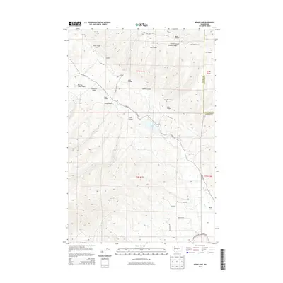
2013 Map of Wenas Lake
USGS Topo · Published 2013About this map
Wenas Lake serves as a central landmark in this rugged corner of Washington, where the high-elevation terrain of the Umtanum Ridge and Cleman Mtn defines the local drainage. The landscape is deeply incised by a series of drainages with descriptive local names, such as Horse-Trough Canyon, Lady Bug Canyon, and Watering Trough Canyon, reflecting the area's history of ranching and water management. The Wenas Cr corridor acts as the primary artery for movement, followed closely by N Wenas Rd as it winds through the Wenas Valley. The transition from the steep canyon walls of Black Canyon to the more open valley floor near Kelley Hollow illustrates the complex geography of the Yakima and Kittitas county border, where land use is dictated by the availability of water in an otherwise arid environment.
Find a feature on this map
42 named features on this map. Tap any name to fly to it.
Don’t see what you’re looking for? This feature index may not catch every label — zoom into the map to look around manually.
Map Details
Editions of this 2013 Wenas Lake Map
This is the sole edition of this map. No revisions or reprints were ever made.
Other maps of this area

1899 · Ellensburg
USGS Topo · 1:125,000

1901 · Ellensburg
USGS Topo · 1:125,000

1950 · Yakima
USGS Topo · 1:250,000
1958 · Ellensburg South
USGS Topo · 1:24,000

1958 · Ellensburg
USGS Topo · 1:62,500
1958 · Selah
USGS Topo · 1:24,000

1958 · Naches
USGS Topo · 1:24,000

1958 · Yakima
USGS Topo · 1:250,000

1961 · Yakima
USGS Topo · 1:250,000
1971 · Milk Canyon
USGS Topo · 1:24,000