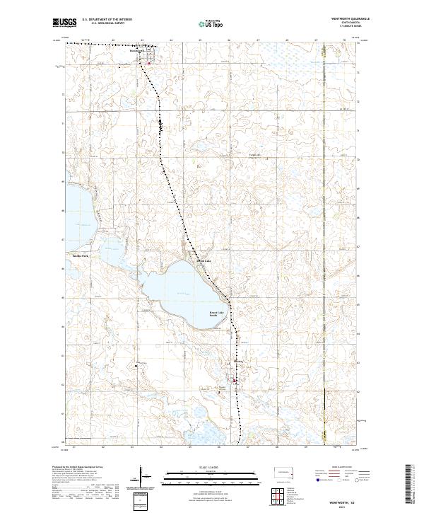
2021 Map of Wentworth
USGS Topo · Published 2021About this map
Brant Lake and the surrounding glaciated plains of the Coteau des Prairies define this portion of the Lake County landscape. The settlement of Wentworth serves as a primary hub in the north, while Chester anchors the southern reaches near the border of Moody County. This survey highlights a region defined by its water bodies and agricultural grid, with residential pockets like Brant Lake South and Smiths Park developed along the shorelines of the major lakes. Genealogists will find significant value in the documentation of local burial grounds, including Rose Hill Cem near the northern border, Prospect Cem to the west, and Pleasant Hill Cem south of Chester. The complex drainage of the prairie is evident in the meandering paths of Skunk Cr, Buffalo Creek, and Bachelor Cr, alongside the marshy expanse of Buffalo Slough.
Find a feature on this map
68 named features on this map. Tap any name to fly to it.
Don’t see what you’re looking for? This feature index may not catch every label — zoom into the map to look around manually.
Map Details
Editions of this 2021 Wentworth Map
This is the sole edition of this map. No revisions or reprints were ever made.
Other maps of this area

1953 · Watertown
USGS Topo · 1:250,000

1955 · Sioux Falls
USGS Topo · 1:250,000

1958 · Sioux Falls
USGS Topo · 1:250,000

1958 · Watertown
USGS Topo · 1:250,000

1962 · Colton SE
USGS Topo · 1:24,000

1963 · Colman
USGS Topo · 1:24,000

1964 · Rutland SE
USGS Topo · 1:24,000

1968 · Lake Madison
USGS Topo · 1:24,000

1968 · Wentworth
USGS Topo · 1:24,000

1968 · Madison
USGS Topo · 1:24,000