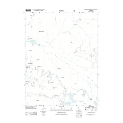
2012 Map of Wentworth Springs
USGS Topo · Published 2012About this map
Wentworth Springs and its surrounding high-elevation landscape define this portion of the Sierra Nevada. This 2012 survey captures a remote region characterized by significant water resources and primitive access routes, where the Rubicon River and its numerous tributaries like Barker Cr and Five Lakes Cr carve through a terrain of granite landmarks. Notable elevations such as Steamboat Mountain and McKinstry Peak overlook a network of alpine lakes and meadows, including Loon Lake, Buck Island Lake, and Dellar Meadow.
Find a feature on this map
75 named features on this map. Tap any name to fly to it.
Don’t see what you’re looking for? This feature index may not catch every label — zoom into the map to look around manually.
Map Details
Editions of this 2012 Wentworth Springs Map
This is the sole edition of this map. No revisions or reprints were ever made.
Other maps of this area

1889 · Pyramid Peak
USGS Topo · 1:125,000

1891 · Truckee
USGS Topo · 1:125,000

1891 · Pyramid Peak
USGS Topo · 1:125,000

1893 · Truckee
USGS Topo · 1:125,000

1895 · Pyramid Peak
USGS Topo · 1:125,000

1895 · Truckee
USGS Topo · 1:125,000

1896 · Pyramid Peak
USGS Topo · 1:125,000

1932 · Truckee
USGS Topo · 1:96,000

1940 · Truckee
USGS Topo · 1:125,000

1947 · Sacramento
USGS Topo · 1:250,000