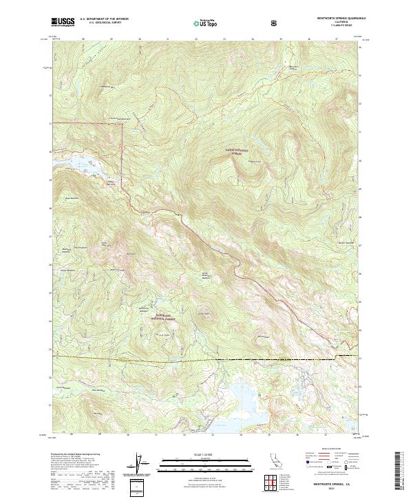
2021 Map of Wentworth Springs
USGS Topo · Published 2021About this map
Wentworth Springs sits at the heart of this high-elevation landscape, where the Rubicon River carves through the transition between Tahoe National Forest and Eldorado National Forest. The 2021 topography reveals a complex network of back-country access, including the Rubicon-Jeep-Trl and Hellhole Trl, which navigate the steep descents toward Hell Hole Reservoir and Upper Hell Hole. The terrain is defined by dramatic geological features such as The Pinnacles, Red Cliffs, and the isolated summit of McKinstry Peak.
Find a feature on this map
77 named features on this map. Tap any name to fly to it.
Don’t see what you’re looking for? This feature index may not catch every label — zoom into the map to look around manually.
Map Details
Editions of this 2021 Wentworth Springs Map
This is the sole edition of this map. No revisions or reprints were ever made.
Other maps of this area

1889 · Pyramid Peak
USGS Topo · 1:125,000

1891 · Truckee
USGS Topo · 1:125,000

1891 · Pyramid Peak
USGS Topo · 1:125,000

1893 · Truckee
USGS Topo · 1:125,000

1895 · Pyramid Peak
USGS Topo · 1:125,000

1895 · Truckee
USGS Topo · 1:125,000

1896 · Pyramid Peak
USGS Topo · 1:125,000

1932 · Truckee
USGS Topo · 1:96,000

1940 · Truckee
USGS Topo · 1:125,000

1947 · Sacramento
USGS Topo · 1:250,000