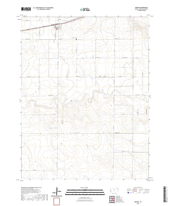
2022 Map of Weskan
USGS Topo · Published 2022About this map
Weskan sits at the northern edge of this high-plains landscape in Wallace County, centered around a grid of rural roads and the intermittent flow of Eagletail Cr. The settlement patterns follow a strict rectangular survey system, with named thoroughfares like Ironhorse Rd and Jackrabbit Rd providing a window into the local naming conventions of this agricultural region. To the south, the terrain becomes more varied as the land rises toward Rock Hill, a prominent topographical landmark in an otherwise gently undulating prairie. This survey also records the location of the Weskan Cem, an essential site for genealogists researching family histories in this western Kansas community. The network of paths, including Killdeer Rd and Gooseberry Rd, illustrates how the community remains connected across large distances in the vast open stretches of the T14S and T15S townships.
Find a feature on this map
19 named features on this map. Tap any name to fly to it.
Don’t see what you’re looking for? This feature index may not catch every label — zoom into the map to look around manually.
Map Details
Editions of this 2022 Weskan Map
This is the sole edition of this map. No revisions or reprints were ever made.
Other maps of this area

1892 · Cheyenne Wells
USGS Topo · 1:125,000

1894 · Cheyenne Wells
USGS Topo · 1:125,000

1954 · Lamar
USGS Topo · 1:250,000

1955 · Scott City
USGS Topo · 1:250,000

1958 · Lamar
USGS Topo · 1:250,000

1958 · Scott City
USGS Topo · 1:250,000

1959 · Weskan
USGS Topo · 1:62,500

1968 · Sharon Springs 3 NE
USGS Topo · 1:24,000

1968 · Sharon Springs 3 NW
USGS Topo · 1:24,000

1969 · Arapahoe SE
USGS Topo · 1:24,000