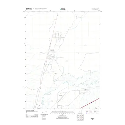
2011 Map of Weso
USGS Topo · Published 2011About this map
The Little Humboldt River converges with the main Humboldt River in this Great Basin landscape, creating a complex hydrology of braided channels and wetlands. The settlement of Weso sits near the southern bend of the river system, serving as a focal point for local transit routes such as Pedroli Ln and Drake Ln. Further east, the community of Tule is marked by a grid of residential roads including Wagon Wheel Ave and Prairie Dog Ave. The terrain is punctuated by Spoon Mountain and the expansive Pioneer Slough, which dominates the central lowlands. Notable landmarks such as the Humboldt Rifle- Pistol Range and the Hay Ranch illustrate the area's mix of recreational use and traditional ranching. The presence of Old Hwy 95 and Old Tollhouse Rd provides a look at the historical transit corridors that preceded the modern highway system.
Find a feature on this map
31 named features on this map. Tap any name to fly to it.
Don’t see what you’re looking for? This feature index may not catch every label — zoom into the map to look around manually.
Map Details
Editions of this 2011 Weso Map
This is the sole edition of this map. No revisions or reprints were ever made.
Other maps of this area

1882 · Paradise
USGS Topo · 1:250,000

1893 · Paradise
USGS Topo · 1:250,000

1932 · Sonoma Range
USGS Topo · 1:250,000

1939 · Sonoma Range
USGS Topo · 1:250,000

1955 · McDermitt
USGS Topo · 1:250,000

1955 · Winnemucca
USGS Topo · 1:250,000

1958 · Winnemucca
USGS Topo · 1:250,000

1958 · Winnemucca
USGS Topo · 1:62,500

1958 · Rose Creek
USGS Topo · 1:62,500

1959 · McDermitt
USGS Topo · 1:250,000