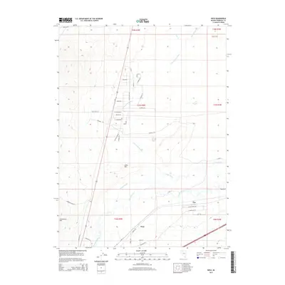
2015 Map of Weso
USGS Topo · Published 2015About this map
The Humboldt River and its complex drainage system dominate this high-desert basin in northern Nevada. The river converges with the Little Humboldt River and Pioneer Slough near the settlement of Weso, creating a localized riparian corridor amidst the surrounding arid plains. The landscape transitions from the level expanses of Dutch Flat in the northeast to more prominent elevations like Spoon Mtn and Winnemucca Mtn in the southwest. A grid of residential roads north of the river, including Bruce Dr and Old Tollhouse Rd, reflects 21st-century development patterns in a region historically defined by its proximity to the railroad and the prominent Big Bend of the river. Farther east, the small settlement of Tule sits along the southern bank, demonstrating how water access continues to dictate human geography in the Great Basin.
Find a feature on this map
45 named features on this map. Tap any name to fly to it.
Don’t see what you’re looking for? This feature index may not catch every label — zoom into the map to look around manually.
Map Details
Editions of this 2015 Weso Map
This is the sole edition of this map. No revisions or reprints were ever made.
Other maps of this area

1882 · Paradise
USGS Topo · 1:250,000

1893 · Paradise
USGS Topo · 1:250,000

1932 · Sonoma Range
USGS Topo · 1:250,000

1939 · Sonoma Range
USGS Topo · 1:250,000

1955 · McDermitt
USGS Topo · 1:250,000

1955 · Winnemucca
USGS Topo · 1:250,000

1958 · Winnemucca
USGS Topo · 1:250,000

1958 · Winnemucca
USGS Topo · 1:62,500

1958 · Rose Creek
USGS Topo · 1:62,500

1959 · McDermitt
USGS Topo · 1:250,000