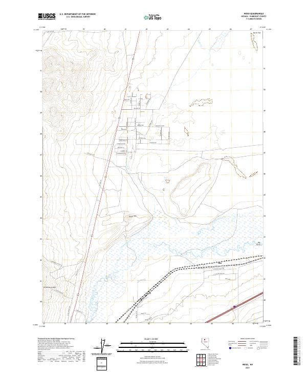
2021 Map of Weso
USGS Topo · Published 2021About this map
Weso and the wetlands surrounding Pioneer Slough define this High Desert landscape where the Little Humboldt River meets the main channel of the Humboldt River. The map captures a critical transition point for regional hydrology and transport, showing the intricate network of sloughs and bends, most notably the Big Bend, that dictate the movement of water and travelers through the Great Basin. To the west, the slopes of Winnemucca Mtn and Spoon Mtn rise sharply from the valley floor, overlooking a residential grid that has expanded into the sagebrush flats along Old Tollhouse Rd and Old Hwy 95. In the northeast, the remote drainage of Pahute Cr and the flats near Dutch Flat point toward the historical mining and ranching trails that once dominated this northern Nevada corridor.
Find a feature on this map
53 named features on this map. Tap any name to fly to it.
Don’t see what you’re looking for? This feature index may not catch every label — zoom into the map to look around manually.
Map Details
Editions of this 2021 Weso Map
This is the sole edition of this map. No revisions or reprints were ever made.
Other maps of this area

1882 · Paradise
USGS Topo · 1:250,000

1893 · Paradise
USGS Topo · 1:250,000

1932 · Sonoma Range
USGS Topo · 1:250,000

1939 · Sonoma Range
USGS Topo · 1:250,000

1955 · McDermitt
USGS Topo · 1:250,000

1955 · Winnemucca
USGS Topo · 1:250,000

1958 · Winnemucca
USGS Topo · 1:250,000

1958 · Winnemucca
USGS Topo · 1:62,500

1958 · Rose Creek
USGS Topo · 1:62,500

1959 · McDermitt
USGS Topo · 1:250,000