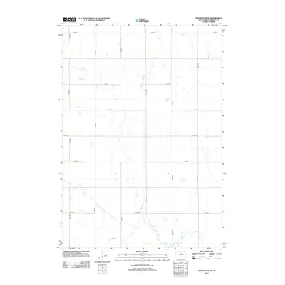
2012 Map of Wessington SE
USGS Topo · Published 2012About this map
The low-lying plains of Beadle County are defined by a rhythmic grid of rural section-line roads and the meandering paths of intermittent prairie streams. Silver Cr flows through the northern and central portions of the quadrangle, while Sand Cr winds across the southern reaches, creating a natural drainage system for the agricultural landscape. The area is precisely divided by a network of numbered thoroughfares such as 210th St and 383rd Ave, reflecting the systematic settlement patterns of the Great Plains. This 2012 survey documents the region's enduring character as an open farming expanse, with numerous small depressions and basins scattered between the road intervals of 379th Ave and 214th St.
Find a feature on this map
17 named features on this map. Tap any name to fly to it.
Don’t see what you’re looking for? This feature index may not catch every label — zoom into the map to look around manually.
Map Details
Editions of this 2012 Wessington SE Map
This is the sole edition of this map. No revisions or reprints were ever made.
Other maps of this area

1898 · Huron
USGS Topo · 1:125,000

1950 · Wessington
USGS Topo · 1:24,000

1950 · Wessington NE
USGS Topo · 1:24,000

1951 · Wessington SE
USGS Topo · 1:24,000

1951 · Wessington SW
USGS Topo · 1:24,000

1953 · Huron
USGS Topo · 1:250,000

1954 · Huron
USGS Topo · 1:250,000
1973 · Wolsey
USGS Topo · 1:24,000

1973 · Wessington Springs NE
USGS Topo · 1:24,000

1973 · Wessington Springs NW
USGS Topo · 1:24,000