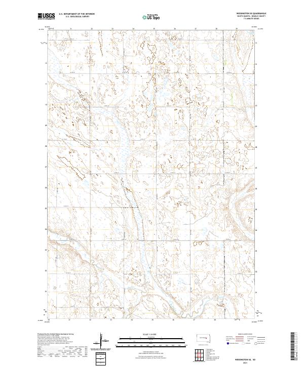
2021 Map of Wessington SE
USGS Topo · Published 2021About this map
Norwegian Slough occupies the northeastern corner of this Beadle County landscape, marking a significant hydrologic feature in an otherwise strictly partitioned prairie. The terrain is defined by the ephemeral flows of Silver Cr and Sand Creek, which meander through a highly organized grid of township and range boundaries. The rectilinear road network, comprised of routes like Co Rd 20 and 382nd Ave, highlights the enduring influence of the Public Land Survey System on South Dakota's rural geography. This 2021 data reflects a region dedicated to large-scale agriculture, where the natural drainage of the Sand Cr basin dictates the placement of section lines and transport corridors. The map provides a precise view of modern rural infrastructure, from county roads to the smaller section paths that facilitate movement across the plains.
Find a feature on this map
25 named features on this map. Tap any name to fly to it.
Don’t see what you’re looking for? This feature index may not catch every label — zoom into the map to look around manually.
Map Details
Editions of this 2021 Wessington SE Map
This is the sole edition of this map. No revisions or reprints were ever made.
Other maps of this area

1898 · Huron
USGS Topo · 1:125,000

1950 · Wessington
USGS Topo · 1:24,000

1950 · Wessington NE
USGS Topo · 1:24,000

1951 · Wessington SE
USGS Topo · 1:24,000

1951 · Wessington SW
USGS Topo · 1:24,000

1953 · Huron
USGS Topo · 1:250,000

1954 · Huron
USGS Topo · 1:250,000
1973 · Wolsey
USGS Topo · 1:24,000

1973 · Wessington Springs NE
USGS Topo · 1:24,000

1973 · Wessington Springs NW
USGS Topo · 1:24,000