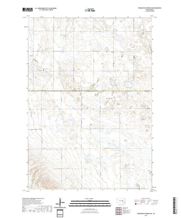
2021 Map of Wessington Springs NE
USGS Topo · Published 2021About this map
Earlville Cem stands as a quiet focal point in this 2021 survey of the prairie landscape where Beadle and Jerauld counties meet. The area is characterized by a high concentration of wetlands and small glacial potholes scattered across the terrain of t109n r65w and surrounding townships. This hydrological pattern defines the land use, with a strictly rectangular grid of section-line roads like 217th St and 382nd Ave navigating around these seasonal water bodies. The drainage of the region is facilitated by the winding paths of Firesteel Cr and Sand Creek, which break the geometric precision of the township lines. The mapping of the Beadle Co Jerauld Co boundary illustrates the intersection of political lines and the natural, watery depressions common to this part of the Dakotas.
Find a feature on this map
25 named features on this map. Tap any name to fly to it.
Don’t see what you’re looking for? This feature index may not catch every label — zoom into the map to look around manually.
Map Details
Editions of this 2021 Wessington Springs NE Map
This is the sole edition of this map. No revisions or reprints were ever made.
Other maps of this area

1898 · Huron
USGS Topo · 1:125,000

1951 · Wessington SE
USGS Topo · 1:24,000

1951 · Wessington SW
USGS Topo · 1:24,000

1953 · Huron
USGS Topo · 1:250,000

1954 · Huron
USGS Topo · 1:250,000

1973 · Wessington Springs NE
USGS Topo · 1:24,000

1973 · Wessington Springs
USGS Topo · 1:24,000

1973 · Wessington Springs NW
USGS Topo · 1:24,000
1973 · Virgil
USGS Topo · 1:24,000
1973 · Woonsocket NW
USGS Topo · 1:24,000