
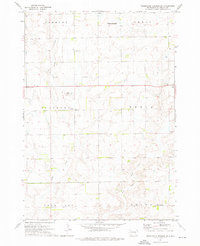
1973 Map of Wessington Springs NW
USGS Topo · Published 1976About this map
The glacial prairie landscape of Jerauld, Hand, and Beadle Counties is captured here in the early 1970s, defined by the narrow, winding waters of Long Lake. This area serves as a National Waterfowl Production Area, reflecting the region's importance for migratory birds within the Missouri Coteau. The map details the rural township structure, including Harmony, Cherry, Burr Oak, and Bates, where small-scale drainage patterns like Smith Creek cut through the undulating plains. The small settlement of Bates is visible in the northwestern corner, representing the quiet agricultural character of the era. Survey benchmarks such as BM 1879 and BM 1950 provide precise elevation data for this segment of the South Dakota prairie.
Find a feature on this map
14 named features on this map. Tap any name to fly to it.
Don’t see what you’re looking for? This feature index may not catch every label — zoom into the map to look around manually.
Map Details
Editions of this 1973 Wessington Springs NW Map
This is the sole edition of this map. No revisions or reprints were ever made.
Other maps of this area

1949 · Vayland SE
USGS Topo · 1:24,000

1951 · Wessington SE
USGS Topo · 1:24,000

1951 · Wessington SW
USGS Topo · 1:24,000

1951 · Vayland SE
USGS Topo · 1:24,000

1953 · Huron
USGS Topo · 1:250,000

1954 · Huron
USGS Topo · 1:250,000

1973 · Wessington Springs NE
USGS Topo · 1:24,000

1973 · Cottonwood Lake
USGS Topo · 1:24,000

1973 · Wessington Springs
USGS Topo · 1:24,000
1973 · Wessington Springs SW
USGS Topo · 1:24,000