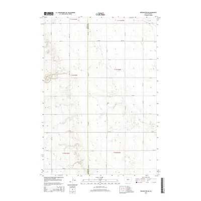
2015 Map of Wessington SW
USGS Topo · Published 2015About this map
Hand and Beadle counties meet in this agricultural landscape defined by a grid of rural roads and seasonal watercourses. The survey area is divided by a series of numbered avenues and streets, where the drainage of Sand Creek and Silver Creek cuts through the undulating prairie. A significant point for local historians is the McNair Cemetery, located near the center of the quadrangle. This feature stands as a tangible marker of early settlement families in a region primarily dedicated to large-scale section farming. The map illustrates the persistent Public Land Survey System (PLSS) grid, showing how early land partitions continued to dictate the infrastructure of South Dakota well into the 21st century.
Find a feature on this map
25 named features on this map. Tap any name to fly to it.
Don’t see what you’re looking for? This feature index may not catch every label — zoom into the map to look around manually.
Map Details
Editions of this 2015 Wessington SW Map
This is the sole edition of this map. No revisions or reprints were ever made.
Other maps of this area

1949 · Vayland SE
USGS Topo · 1:24,000

1950 · Vayland
USGS Topo · 1:24,000

1950 · Wessington
USGS Topo · 1:24,000

1950 · Wessington NE
USGS Topo · 1:24,000

1951 · Wessington SE
USGS Topo · 1:24,000

1951 · Wessington SW
USGS Topo · 1:24,000

1951 · Vayland SE
USGS Topo · 1:24,000

1953 · Huron
USGS Topo · 1:250,000

1954 · Huron
USGS Topo · 1:250,000

1973 · Wessington Springs NE
USGS Topo · 1:24,000