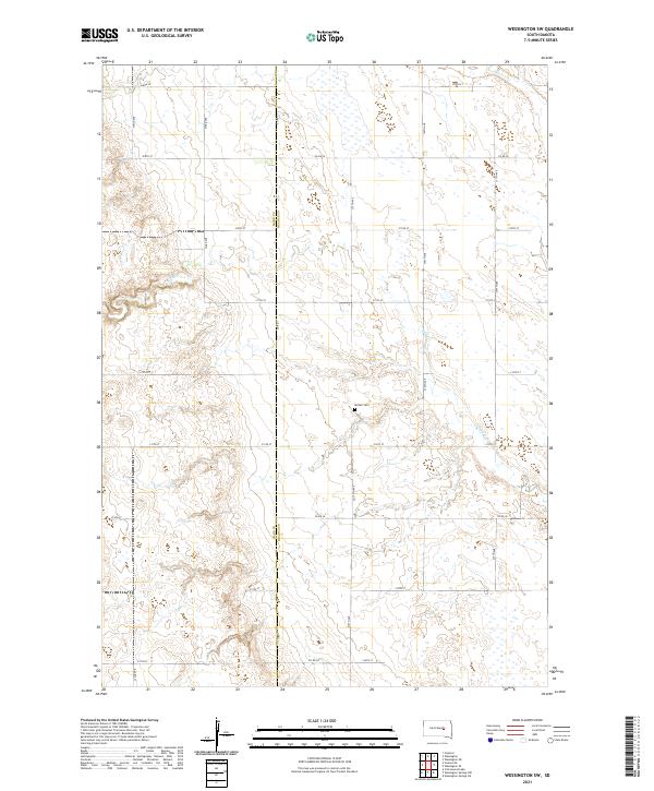
2021 Map of Wessington SW
USGS Topo · Published 2021About this map
The Hand Co Beadle Co border runs vertically through this prairie landscape, marking a transition in the agricultural grid of East Central South Dakota. The terrain is defined by its drainage patterns, with Sand Creek winding through the central and southern reaches of the quadrangle while Silver Creek touches the northern edge. At the heart of the rural township, the McNair Cemetery sits near the junction of 375th Ave and 213th St, serving as a silent record of the families who settled this open country. The map illustrates a strictly organized section-line road system, including routes like Co Rd 1 and Co Rd 20, which facilitate the region's vast farming operations. This survey reflects the enduring spatial layout of the Great Plains, where natural waterways like Sand Creek provide the only variation in an otherwise rectilinear human landscape.
Find a feature on this map
28 named features on this map. Tap any name to fly to it.
Don’t see what you’re looking for? This feature index may not catch every label — zoom into the map to look around manually.
Map Details
Editions of this 2021 Wessington SW Map
This is the sole edition of this map. No revisions or reprints were ever made.
Other maps of this area

1949 · Vayland SE
USGS Topo · 1:24,000

1950 · Vayland
USGS Topo · 1:24,000

1950 · Wessington
USGS Topo · 1:24,000

1950 · Wessington NE
USGS Topo · 1:24,000

1951 · Wessington SE
USGS Topo · 1:24,000

1951 · Wessington SW
USGS Topo · 1:24,000

1951 · Vayland SE
USGS Topo · 1:24,000

1953 · Huron
USGS Topo · 1:250,000

1954 · Huron
USGS Topo · 1:250,000

1973 · Wessington Springs NE
USGS Topo · 1:24,000