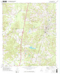
1972 Map of Wesson
USGS Topo · Published 1974About this map
Wesson and Beauregard serve as the primary anchors of this 1970s landscape, situated along the Illinois Central Gulf rail corridor. The map highlights a significant academic presence at Copiah-Lincoln Jr College, while the surrounding rural terrain is dotted with generational landmarks like Mathews Chapel and the St Peter Rock Cem. To the south, the settlement of New Sight sits near the Treaty and Indian Boundary lines, offering a clear record of historical land divisions that shaped the Copiah and Lincoln county border. A network of Gravel Pits and various creek systems, including Bahala and Clear creeks, illustrate the local industry and drainage patterns. Notable family and community sites such as Zion Hill Ch Cem and Hillcrest Ch provide essential data for genealogists tracing roots through these central Mississippi communities.
Find a feature on this map
46 named features on this map. Tap any name to fly to it.
Don’t see what you’re looking for? This feature index may not catch every label — zoom into the map to look around manually.
Map Details
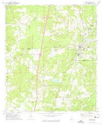
Editions of this 1972 Wesson Map
2 editions found
Other maps of this area

1953 · Natchez
USGS Topo · 1:250,000

1956 · Natchez
USGS Topo · 1:250,000

1959 · Natchez
USGS Topo · 1:250,000

1963 · Smyrna
USGS Topo · 1:24,000

1963 · Hazlehurst
USGS Topo · 1:24,000

1963 · Shady Grove
USGS Topo · 1:24,000

1972 · Fair Oak Springs
USGS Topo · 1:24,000

1972 · Midway
USGS Topo · 1:24,000
1972 · Stronghope
USGS Topo · 1:24,000

1972 · Brookhaven
USGS Topo · 1:24,000