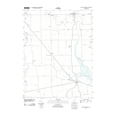
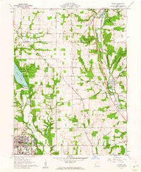
2010 Map of West Alexandria
USGS Topo · Published 2010About this map
Twin Creek and its many tributaries, including Aukerman Creek and Bantas Fork, carve a path through this agricultural section of Preble County. The landscape is dotted with small settlements like West Alexandria, Gratis, and Wheatville, connected by a dense network of country roads including Quaker Trace Rd and Wayne Trace Rd. This area is particularly rich for genealogical research, featuring over a dozen burial grounds such as the Sugar Hill German Baptist Cemetery and the Eikenberry-Wheatville Cemetery. A notable architectural landmark, the Roberts Covered Bridge, stands near Rocky Run, while the Preble County Fairgrounds sit on the outskirts of Eaton. The map also preserves the locations of several historic crossings, including Wolfs Ford and Guggs Ford, reflecting an era of local travel before modern infrastructure fully bridged these waterways.
Find a feature on this map
71 named features on this map. Tap any name to fly to it.
Don’t see what you’re looking for? This feature index may not catch every label — zoom into the map to look around manually.
Map Details
Editions of this 2010 West Alexandria Map
This is the sole edition of this map. No revisions or reprints were ever made.
Other maps of this area

1905 · Brookville
USGS Topo · 1:62,500

1908 · Miamisburg
USGS Topo · 1:62,500

1911 · Oxford
USGS Topo · 1:62,500

1953 · Cincinnati
USGS Topo · 1:250,000

1957 · Cincinnati
USGS Topo · 1:250,000
1959 · Middletown
USGS Topo · 1:24,000
1960 · Eaton North
USGS Topo · 1:24,000

1960 · Farmersville
USGS Topo · 1:24,000
1960 · Eaton South
USGS Topo · 1:24,000
1961 · Oxford
USGS Topo · 1:24,000