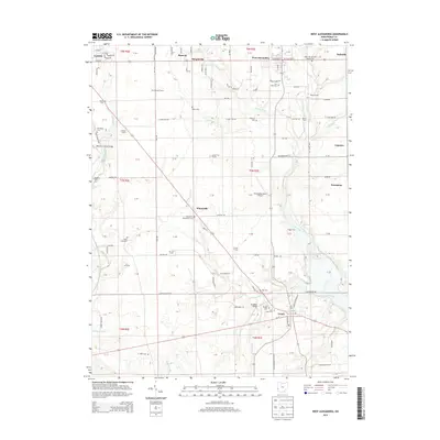
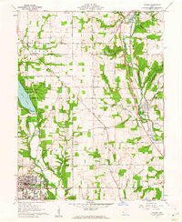
2013 Map of West Alexandria
USGS Topo · Published 2013About this map
Twin Creek and Bantas Fork dominate the landscape of Preble County in this 2013 survey, where agricultural heritage is preserved through numerous family farms and historical crossings. Named holdings like Dorchasland Farms, Durham Farms, and Grass Fed Farms signify a transition toward specialized modern agriculture, yet the region remains anchored by its past. Local history is deeply embedded in the numerous burial grounds, including the Sugar Hill German Baptist Cem and Elkenberry Wheatville Cem. The map highlights engineering landmarks such as the Roberts Covered Bridge near Eaton and the Brubaker Bridge further south. Small clusters like Wheatville, Sampleville, and Ingomar dot the township grid, connected by a network of rural roads that frequently cross the water at historic points like Wolf's Ford and Moore Ford. Rural aviation is represented by the Morningstar North Airport, located between West Alexandria and the small community of Enterprise.
Find a feature on this map
141 named features on this map. Tap any name to fly to it.
Don’t see what you’re looking for? This feature index may not catch every label — zoom into the map to look around manually.
Map Details
Editions of this 2013 West Alexandria Map
This is the sole edition of this map. No revisions or reprints were ever made.
Other maps of this area

1905 · Brookville
USGS Topo · 1:62,500

1908 · Miamisburg
USGS Topo · 1:62,500

1911 · Oxford
USGS Topo · 1:62,500

1953 · Cincinnati
USGS Topo · 1:250,000

1957 · Cincinnati
USGS Topo · 1:250,000
1959 · Middletown
USGS Topo · 1:24,000
1960 · Eaton North
USGS Topo · 1:24,000

1960 · Farmersville
USGS Topo · 1:24,000
1960 · Eaton South
USGS Topo · 1:24,000
1961 · Oxford
USGS Topo · 1:24,000