2023 Map of West Alexandria
USGS Topo · Published 2023About this map
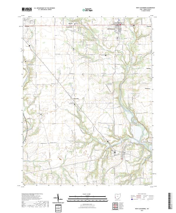
West Alexandria serves as a central hub in this section of Preble County, where the waters of Twin Creek and Bantas Fork converge. The landscape is defined by a dense network of rural settlements, including Gratis, Enterprise, Ingomar, and Wheatville, connected by a grid of agricultural roads such as Halderman Rd and Enterprise Rd. This 2023 survey reveals a high concentration of small family and community burial grounds, from Sugar Hill Cem in the north to Davis Cem in the south, suggesting a long history of local lineage and homesteading. Aviation is represented by Morningside North Airport, while the terrain is shaped by numerous drainages like Aukerman Creek and Sevenmile Creek that feed into the larger valley systems.
Find a feature on this map
59 named features on this map. Tap any name to fly to it.
Don’t see what you’re looking for? This feature index may not catch every label — zoom into the map to look around manually.
Map Details
Editions of this 2023 West Alexandria Map
This is the sole edition of this map. No revisions or reprints were ever made.