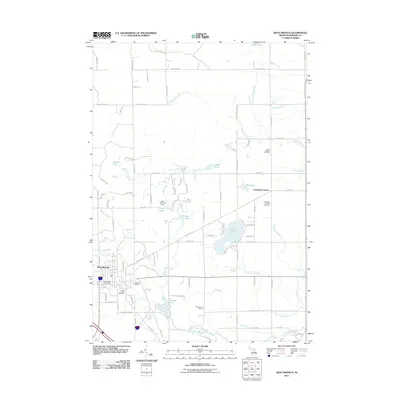
2011 Map of West Branch
USGS Topo · Published 2011About this map
West Branch serves as the focal point of this Ogemaw County survey, situated at the confluence of several vital waterways including Ogemaw Creek and Brewery Creek. The town's civic structure is marked by the West Branch Post Office and multiple burial grounds such as Brookside Cemetery and Saint Joseph's Cemetery. Northeast of the city, Campbells Corners remains a distinct community node with its own Campbells Corners Cemetery, illustrating the persistent cluster-settlement patterns of rural Michigan.
Find a feature on this map
103 named features on this map. Tap any name to fly to it.
Don’t see what you’re looking for? This feature index may not catch every label — zoom into the map to look around manually.
Map Details
Editions of this 2011 West Branch Map
This is the sole edition of this map. No revisions or reprints were ever made.
Other maps of this area

1954 · Traverse City
USGS Topo · 1:250,000

1958 · Traverse City
USGS Topo · 1:250,000

1965 · Damon
USGS Topo · 1:24,000

1965 · St. Helen NE
USGS Topo · 1:24,000

1965 · West Branch
USGS Topo · 1:24,000

1965 · Ogemaw Springs
USGS Topo · 1:24,000

1965 · Selkirk
USGS Topo · 1:24,000

1965 · Rose City
USGS Topo · 1:24,000
1968 · Skidway Lake
USGS Topo · 1:24,000

1968 · Sterling NW
USGS Topo · 1:24,000