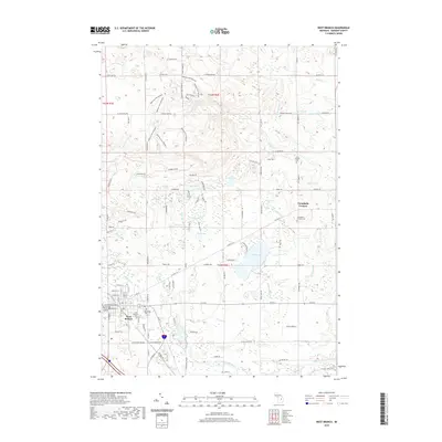
2019 Map of West Branch
USGS Topo · Published 2019About this map
The West Branch area serves as the seat of Ogemaw County, organized around the confluence of regional travel corridors and the West Branch Rifle River. This landscape is defined by its complex hydrology, where numerous smaller bodies of water like Rifle Lake, Peach Lake, and Deer Lake dot the terrain among the headwaters of Klacking Cr and Crapo Cr. The settlement pattern shows the concentrated growth of the county seat near the Ogemaw County Building, while outlying areas like Campbells Corners and Brookside maintain a more rural character. The northern section of the map is dominated by the Ogemaw Hills Pathway, indicating a landscape transitioning from the developed town center to protected recreation and timber lands. Genealogists will find several burial sites preserved here, including the Saint Joseph's Cem and Campbells Corners Cem, which anchor the local history of these communities.
Find a feature on this map
79 named features on this map. Tap any name to fly to it.
Don’t see what you’re looking for? This feature index may not catch every label — zoom into the map to look around manually.
Map Details
Editions of this 2019 West Branch Map
This is the sole edition of this map. No revisions or reprints were ever made.
Other maps of this area

1954 · Traverse City
USGS Topo · 1:250,000

1958 · Traverse City
USGS Topo · 1:250,000

1965 · Damon
USGS Topo · 1:24,000

1965 · St. Helen NE
USGS Topo · 1:24,000

1965 · West Branch
USGS Topo · 1:24,000

1965 · Ogemaw Springs
USGS Topo · 1:24,000

1965 · Selkirk
USGS Topo · 1:24,000

1965 · Rose City
USGS Topo · 1:24,000
1968 · Skidway Lake
USGS Topo · 1:24,000

1968 · Sterling NW
USGS Topo · 1:24,000