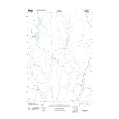
2012 Map of West Burke
USGS Topo · Published 2012About this map
Center Pond and Newark Pond anchor the northern landscape of this corner of Caledonia County, where the topography is defined by significant elevations like McSherry Mountain and Walker Mountain. The area is characterized by a network of brooks and river branches, including the W Br Passumpsic River and E Br Passumpsic River, which carve through the terrain near small crossroads such as Newark Hollow and East Haven. Local industry and conservation are noted at the Bald Hill Hatchery, while the human history of the region is preserved in numerous family and community burial grounds like Hillside Cem and Packer Cem. The map illustrates a rural settlement pattern where life follows the ridges and valleys, connected by winding routes like Newark St and Burke Hollow Rd.
Find a feature on this map
91 named features on this map. Tap any name to fly to it.
Don’t see what you’re looking for? This feature index may not catch every label — zoom into the map to look around manually.
Map Details
Editions of this 2012 West Burke Map
This is the sole edition of this map. No revisions or reprints were ever made.
Other maps of this area

1919 · Lake Memphremagog
USGS Topo · 1:62,500

1920 · Derby
USGS Topo · 1:62,500

1923 · Lake Memphremagog
USGS Topo · 1:48,000

1924 · Island Pond
USGS Topo · 1:48,000

1925 · Memphremagog
USGS Topo · 1:62,500

1926 · Island Pond
USGS Topo · 1:62,500

1935 · Lyndonville
USGS Topo · 1:48,000

1939 · Lyndonville
USGS Topo · 1:62,500

1950 · Lake Champlain
USGS Topo · 1:250,000

1950 · Lewiston
USGS Topo · 1:250,000