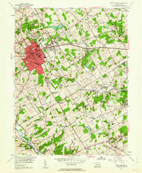
1954 Map of West Chester
USGS Topo · Published 1962About this map
West Chester serves as the central hub of this mid-century Pennsylvania landscape, dominated by the campus of the State Teachers College and several historic burial grounds like Oaklands Cem and Green Mount Cem. The map illustrates a transitional period of suburban expansion into the townships of East Goshen and West Goshen, where established settlements like Goshenville and Chatwood sit alongside newer developments. The southern portion of the sheet transitions into a more rural, rolling landscape toward the Brandywine Creek, dotted with family-named landmarks and old road junctions. Significant institutions of the era are clearly marked, including the Dante Orphanage and the County Prison. The transit network is a mix of traditional turnpikes like Paoli Pike and Baltimore Pike, and the active Pennsylvania railroad line, showing the infrastructure that supported the county seat's growth.
Find a feature on this map
98 named features on this map. Tap any name to fly to it.
Don’t see what you’re looking for? This feature index may not catch every label — zoom into the map to look around manually.
Map Details
Editions of this 1954 West Chester Map
4 editions found
Other maps of this area

1894 · Chester
USGS Topo · 1:62,500

1894 · Norristown
USGS Topo · 1:62,500

1895 · Norristown
USGS Topo · 1:62,500

1896 · Norristown
USGS Topo · 1:62,500

1896 · Chester
USGS Topo · 1:62,500

1898 · Chester
USGS Topo · 1:62,500

1901 · Camden
USGS Topo · 1:125,000

1901 · West Chester
USGS Topo · 1:62,500

1904 · West Chester
USGS Topo · 1:62,500

1906 · Phoenixville
USGS Topo · 1:62,500
Featured Places
- West Goshen Township, PA
- West Chester, PA
- Willistown Township, PA
- Westtown, Thornbury Township
- Birmingham Township, PA