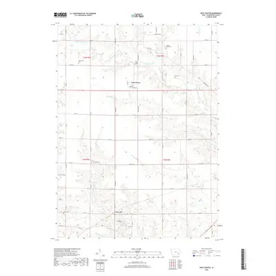
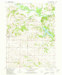
2018 Map of West Chester
USGS Topo · Published 2018About this map
West Chester serves as the primary settlement on this landscape, situated at the intersection of Main St and Hemlock Ave. The surrounding rural countryside in Washington County is defined by a dense concentration of local burial grounds, indicating a deeply rooted community history. Notable sites include Westminster Cem, Roberts Chapel Cem, and New Haven Cem, which are scattered among the drainages of W Fork Crooked Cr and Clemons Cr. To the south, the small community of Grace Hill is anchored by its own Grace Hill Cem and Todd Cem. The terrain transitions from flat agricultural uplands into more dissected areas like Hoot Owl Hollow and the valley of Cedar Cr, while Sunrise Lake provides a distinct water feature in the southeastern portion of the quadrangle.
Find a feature on this map
47 named features on this map. Tap any name to fly to it.
Don’t see what you’re looking for? This feature index may not catch every label — zoom into the map to look around manually.
Map Details
Editions of this 2018 West Chester Map
This is the sole edition of this map. No revisions or reprints were ever made.
Other maps of this area

1958 · Davenport
USGS Topo · 1:250,000

1961 · Davenport
USGS Topo · 1:250,000

1962 · Davenport
USGS Topo · 1:250,000

1969 · Kalona
USGS Topo · 1:24,000

1969 · Washington
USGS Topo · 1:24,000
1973 · Wellman
USGS Topo · 1:24,000
1973 · Keota
USGS Topo · 1:24,000

1973 · West Chester
USGS Topo · 1:24,000
1973 · Kinross
USGS Topo · 1:24,000
1980 · Richland
USGS Topo · 1:24,000