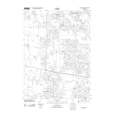
2012 Map of West Chicago
USGS Topo · Published 2012About this map
The W Br Du Page River meanders southward through this suburban landscape, anchoring several established communities including Bartlett and West Chicago. The map captures a high density of local heritage sites, particularly cemeteries like the Old Ontarioville Cem and Wayne Township Cem, which offer significant value for genealogical research in Kane and DuPage counties. Suburban development is interspersed with recreational and institutional grounds, such as the Saint Andrews Golf Course and Wheaton College Academy. Transportation infrastructure is a dominant feature, with the expansive Dupage Airport in the southwest and major thoroughfares like Army Trail Rd and St. Charles Rd connecting the residential centers. Cultural landmarks, such as the Cascade Outdoor Theatre near Prince Crossing, reflect the transition of the area from a series of independent settlements like Ingalton and Schick into a contiguous suburban corridor.
Find a feature on this map
43 named features on this map. Tap any name to fly to it.
Don’t see what you’re looking for? This feature index may not catch every label — zoom into the map to look around manually.
Map Details
Editions of this 2012 West Chicago Map
This is the sole edition of this map. No revisions or reprints were ever made.
Other maps of this area

1908 · Wheaton
USGS Topo · 1:62,500

1923 · Barrington
USGS Topo · 1:62,500

1925 · Elgin
USGS Topo · 1:62,500

1932 · Geneva
USGS Topo · 1:62,500

1935 · Barrington
USGS Topo · 1:62,500

1940 · Elgin
USGS Topo · 1:62,500

1948 · Wheaton
USGS Topo · 1:62,500

1948 · Geneva
USGS Topo · 1:62,500

1949 · Geneva
USGS Topo · 1:24,000

1950 · Aurora North
USGS Topo · 1:24,000